July 31, 2001 - Mike and Marilyn's 2001 TranAmerican Bike Tour
Mike and Marilyn's
2001 TransAm Bike Trip
Main menu:
July 31, 2001
TRANSAM 2001 > Idaho
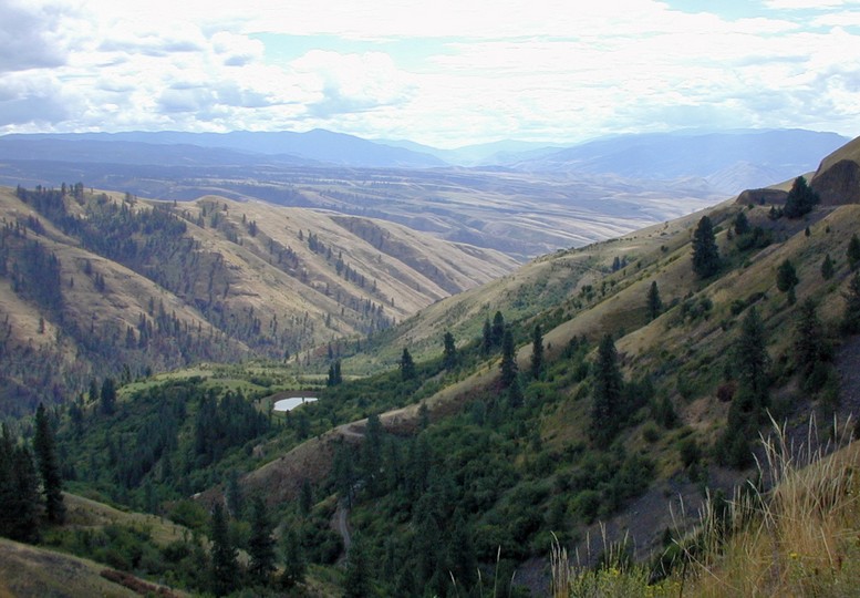
 Harpster to Riggins, Idaho. (62 mi.) Mile 3635Blue skies, White Bird, Salmon RiverToday was a visual treat, and fortunately, Mike was able to see it clearly. Over the last week he has noticed that his vision has been changing, and he has not been able to see distant objects as clearly as he could at the beginning of the trip. He has also been feeling under the weather, as if some sort of bug has been sapping his energy. This was worrying us as we started out of Harpsters' campground.In addition it had rained all night, and though we were dry and warm in the tent, it distracted us from sleeping well wondering if we would have another day of rain. However, morning brought patches of blue sky, and clouds were lifting off the hills as we climbed the 6% uphill grade to Camas Prairie and Grangeville. This fertile prairie once provided the camas root that was a staple in the diet of the Nez Perce, but today, it is rangeland and wheat fields.
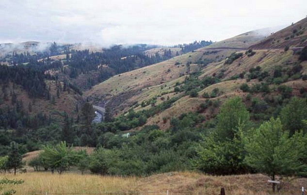 Mist and clouds lifted off Harpster Grade as we climbed from the river to Camas PrairieCamas Prairie, riding toward Grangeville

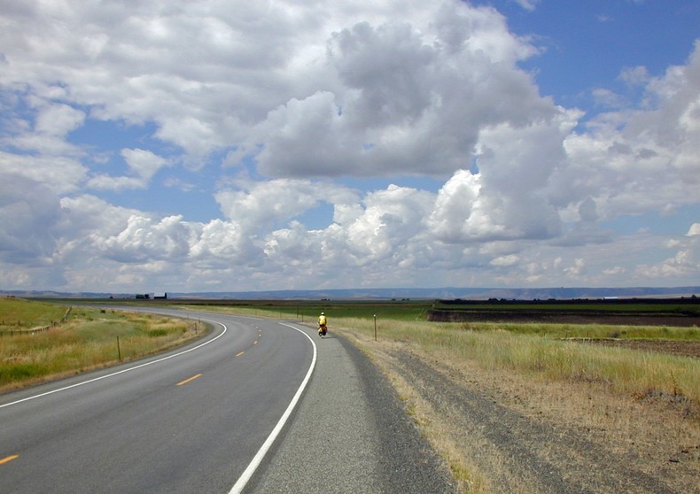
The sun shines through the clouds over Camas Prairie near Grangeville
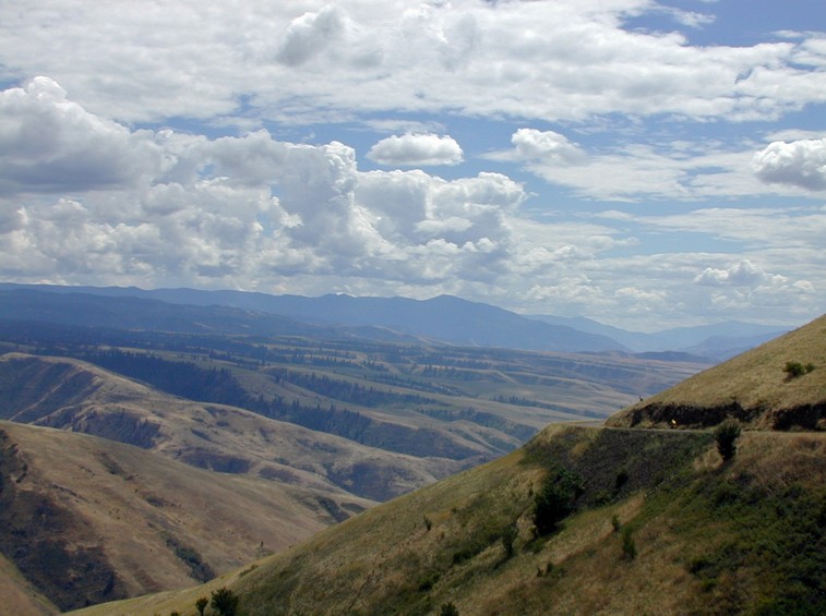
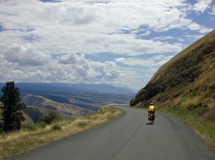
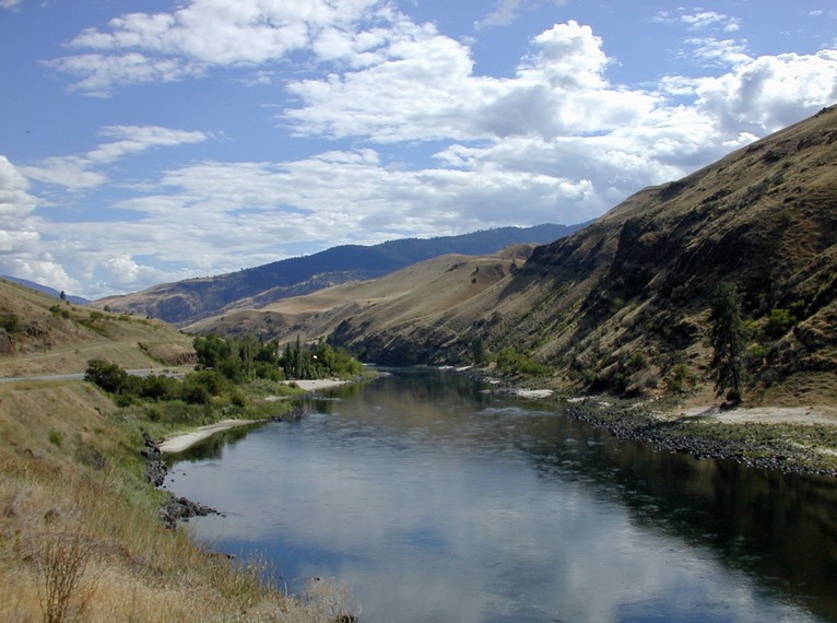
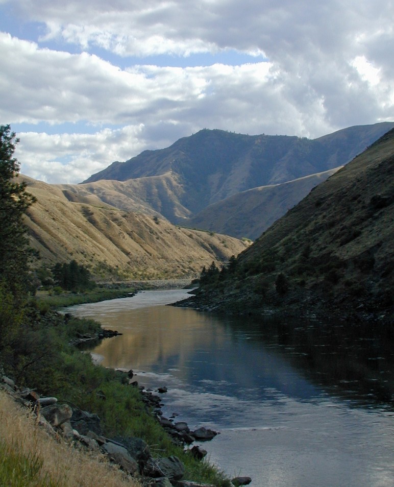
Our first business in Grangeville was to find any optometrist's office, so it was good fortune when we noticed a sign on Main Street with letters big enough for Mike to read, "EYE CLINIC". Dr. Jerry Cowan was great in seeing Mike without an appointment, confirming that he needed stronger lenses, and providing him with appropriate contacts for the rest of the trip. Everything else checked out OK, which was reassuring, and Mike headed off with clear vision.After more climbing, we came to the top of White Bird Hill and a spectacular panoramic view of the Salmon River Canyon below. Our descent to the tiny town of White Bird on traffic free old White Bird Hill Road was another scenic highlight of our trip. In the 11.6 miles of hairpin curves, we dropped the 2,200 feet it had taken us all morning to climb. As we descended into the Salmon River valley, we left the cold, cloudy mountain weather behind and entered warmth and sunshine. At the bottom of the canyon, we passed another site of a battle between the Nez Perce and the U.S. army in 1877, which was won by the Nez Perce. We can understand their reluctance to leave their homeland here.White Bird HillI am the speck on old White Bird Hill Road in the distance.Another view riding down White Bird Hill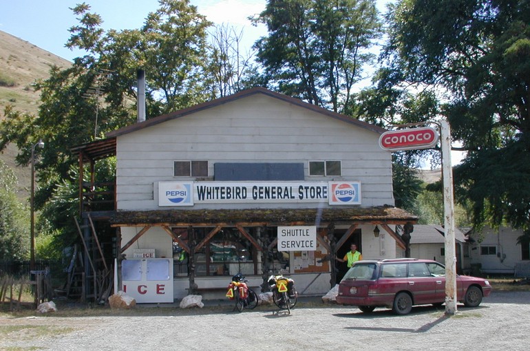 The market at the tiny town of White BirdFor a finale, we followed the Salmon River Canyon on the river side for 19 flat miles to Riggins, Whitewater Capital of Idaho. The Salmon River cut this canyon through basalt lava flows over 15 million years ago. Each bend in the river offered a new and beautiful variation on this scenic canyon. We stopped once at a fruit stand, bought ripe nectarines and apricots, and fixed the fourth flat of the trip. Riggins is not much more than a narrow main street crowded against the side of the canyon, consisting of a number of whitewater rafting outfitters, tourist and support services. We chose to camp at the Riverside RV Park, but the four tent sites were taken. A group of Harley motorcyclists welcomed us to share their site with them. We have found that motorcyclists are among the friendliest travelers we encounter. They cover far more miles on far fewer calories (well, some appear to eat as many calories as we do), but they share many similar experiences on their bikes.Entering the Salmon River CanyonSalmon River Canyon